Fall 2017–Winter 2018
Interstitial Image
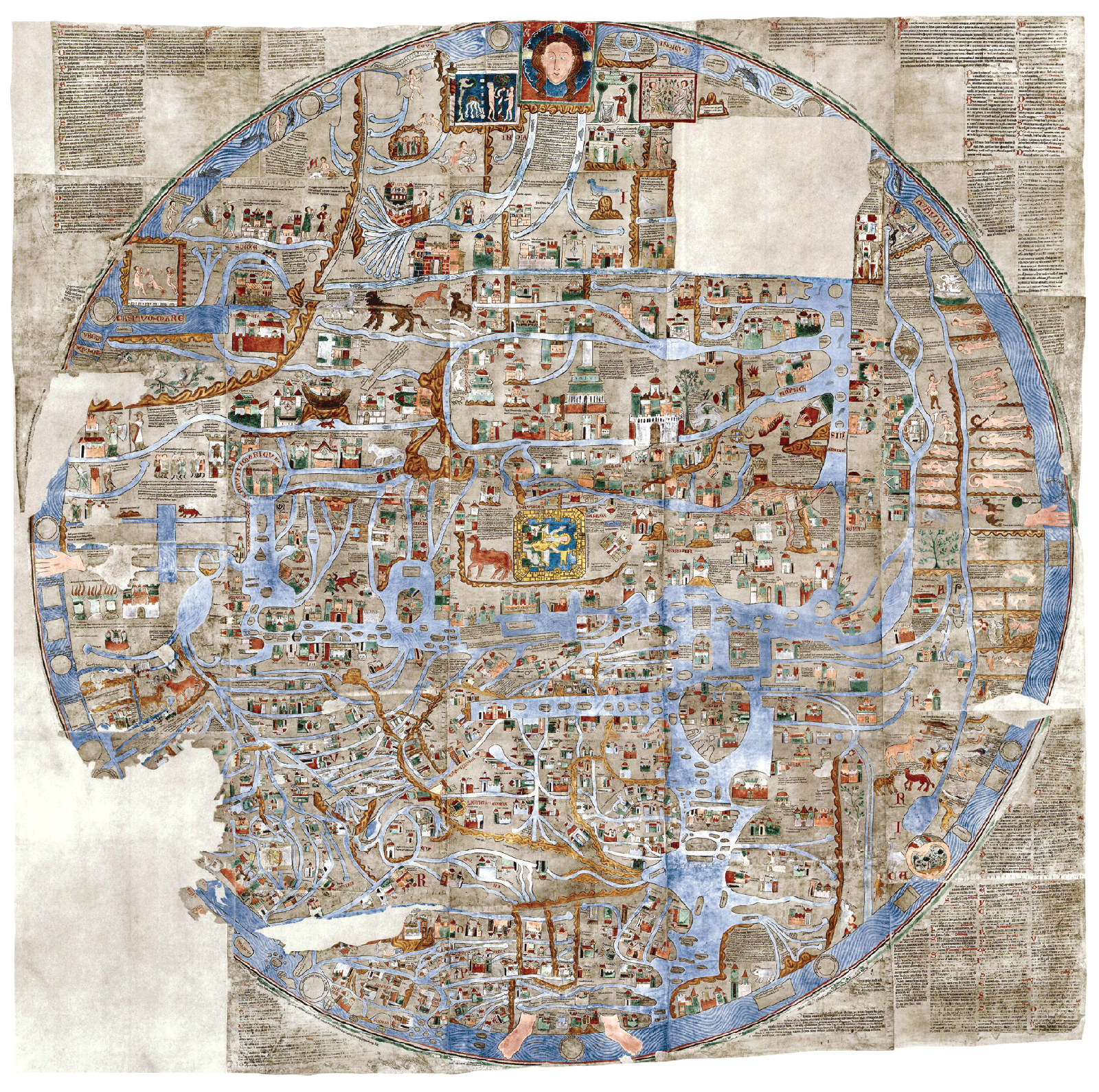
Facsimile of the thirteenth-century Ebstorf Map, the vellum original of which was destroyed in October 1943 during the Allied bombings of Hanover. At nearly twelve feet by twelve feet, it is one of the largest of the known medieval mappae mundi. The radial map was discovered ca. 1830 in what is now Lower Saxony, and depicts the world incorporated within the body of the crucified Christ, whose head, hands, and feet are situated at the four major points of the compass rose.
Spotted an error? Email us at corrections at cabinetmagazine dot org.
If you’ve enjoyed the free articles that we offer on our site, please consider subscribing to our nonprofit magazine, which includes unlimited access to all our archives.